Malawi Overview (as of 2010)
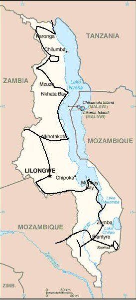
Malawi at 118,000 km2 (UK 243,000 km2), a fifth of which is water, is slightly smaller than England. It has a population of 15,300,000 (UK 62,000,000) and a population density of per 128.4 km2 (UK 255 per km2) making it one of the more densely populated African nations
A landlocked country dominated by Lake Malawi and bordered by 3 countries: Tanzania for 475 km; Zambia for 837 km; Mozambique for 1569 km. Formerly Nyasaland.
Low point = 37 metres Shire River: High point = 3,002 metres Mulanje Mountain
Capital - Lilongwe
Official language - English & Chichwa
Entry issues: Passports with 3 months remaining after departure. Visas not required by UK Nationals for 90 day stay.
Very relaxed border crossings
Vehicle issues: Carnet de Passage required. Photo driving licence or international licence required. Drive on left. Insurance, third party, for 30 days = US$50, from independent agent within border. Disc to be displayed in windscreen. No requirement to pay Road Toll being a light vehicle.
2 warning triangles and fire extinguisher required.
Keep all documents to hand, but secure, for occasional police checks.
Police checks not as frequent as some countries and all very friendly.
Petrol and Diesel widely available at most towns and large villages. All garages are cash only, all attended and usually with a screen washer – small tip usual. As with all of Africa, will squeeze as much in as possible, usually leading to spills!
Average cost of diesel = £0.90 – by far the most expensive in the region; price appears to be fixed for all garages.
Banks; ATMs; Credit Cards
ATMs could be very challenging, mainly available in the larger towns but even these were a problem. Credit cards accepted in the larger supermarkets in the larger towns but these were very few and very far between.
Telephones: International dialling code +265. Fairly good mobile coverage in towns and along major routes. We used Malawian Zain. Cheap SIMs and top up cards widely available from street sellers.
Time (UTC = Coordinated Universal Time, equal to GMT) = UTC+02
Currency & UK£ rate at time of visit:
Malawian Kwacha MK (MK1 = 100 tambala)
£1 = MK217: 1000 Kwacha = £4.60
GARAGES
BLANTYRE
City Motors Land Rover Garage, Blantyre.
Tel 01670377
Coordinates: S15 47.866 E35 01.157.
Wi-fi when working!
Rear offside trailing arm bracket welded – oval hole made good. New Land Rover rear brake pads. Land Rover prices being a franchised garage.
Route and Camping - Malawi
Day 179 - Thursday 6th August 2009 CONTINUED
Tanzania to Malawi
Trip miles = 12865 miles (20584 kms) Daily miles from border = 30 miles (48 kms)
Daily Route – Matema to Songwe border crossing and to Karonga, Malawi.
Camping – Mufwa Lodge, Karonga. A strange set-up with no defined pitches in the large grounds. There were rooms along one side of the grounds that filled up later with workers. Shared ablution block with the rooms. No electricity.
Cost – MK700 per person per night.
Coordinates - S9 56.251 E33 56.667
Altitude = 485 metres
Day 180 - Friday 7th August 2009
Trip miles = 13010 miles (20816 kms) Daily miles = 145 miles (232 kms)
Daily Route – Karonga out on the M26 to Tondola, then south to Mafinga and down the M9 to the Kaperekezi Gate into the Nyika National Park.
Camping –Chelinda Camping (Not the now deserted Chelinda Camp), Nyika National Park. A lovely location looking out over the rolling grasslands but now very run down. The ground was very uneven and sloping making it difficult to set up. The other couple pitched their ground tent in the shelter. Run down ablutions but hot showers. No electricity. Wood provided.
Cost – MK1000 per person per night.
Coordinates - S10 09.56.251 E33 56.667
Altitude = 2333 metres
Park fees – quoted in US$ but will take kwachas: US$5 per person per 24 hours + US$2 per vehicle per 24 hours. We paid MK3480 rather than the US$24.
Day 181 - Saturday 8th August 2009
Trip miles = 13084 miles (20934 kms) Daily miles = 74 miles (118 kms)
Daily Route – In and around Nyika National Park.
Camping – as previous night but no water and therefore no showers and non-flushing toilets!
Day 182 - Sunday 9th August 2009
Trip miles = 13156 miles (21050 kms) Daily miles = 72 miles (115 kms)
Daily Route – Nyika National Park to Vwaza Marsh Wildlife Reserve.
Camping – Kazuni Camp, Vwaza Marsh Wildlife Reserve. A lovely spot overlooking the lake with wild animals wandering all around. Good ablution block but some walk: no water while we were there. Individual reed huts at most pitches but it turned out these were for hire and not for camping. Braai area. No electricity.
Cost – MK1000 per person per night.
Coordinates - S11 08.039 E33 39.201
Altitude =1086 metres
Park fees – MK750 per person per day + MK300 per vehicle per day.
Game walk – MK750 per person.
Day 183 - Monday 10th August 2009
Trip miles = 13173 miles (21077 kms) Daily miles = 17 miles (27 kms)
Daily Route – In and around Vwaza Marsh Wildlife Reserve.
Camping – as previous night.
Bird walk – MK750 per person.
Day 184 - Tuesday 11th August 2009
Trip miles = 13264 miles (21222 kms) Daily miles = 91 miles (146 kms)
Daily Route – Vwaza Marsh Wildlife Reserve to Rumphi, down to Mzuzu and across to Nkhata Bay on Lake Malawi.
Camping – Nkukuti Beach Resort near Nkhata Bay. Not ideal at all even though it was on the lawn right next to the beach. Quite a few persistent sellers and others wanting to help, but bearable. Allocated room for shower, toilets in restaurant. No electricity.
Cost – MK750 per person per night.
Coordinates - S11 37.060 E34 18.266
Altitude = 481 metres
Day 185 - Wednesday 12th August 2009
Trip miles = 13306 miles (21290 kms) Daily miles = 42 miles (67 kms)
Daily Route – Nkhata Bay down to Mwana Beach on Lake Malawi.
Accommodation – log cabins within Centre grounds with lake view. Good ablution block with hot showers. No electricity.
Cost – MK1400 per person per night.
Coordinates - S11 58.951 E34 04.736
Altitude = 475 metres
Day 186 - Thursday 13th August 2009
Trip miles = 13306 miles (21290 kms) Daily miles = 0 miles (0 kms)
Daily Route – In and around Mwana Beach on Lake Malawi.
Accommodation – as previous night.
Day 187 - Friday 14th August 2009
Trip miles = 13439 miles (21502 kms) Daily miles = 133 miles (213 kms)
Daily Route – Mwana Beach on Lake Malawi to Nkhotakota and east into Nkhotakota Wildlife Reserve.
Camping – A strange place in the middle of nowhere that appears to be little use. Ranger and children a little over-bearing. What should have been the ablution block had long since ceased to function. No electricity.
Cost – US$1.50 per person per night.
Coordinates - S13 04.573 E33 56.225
Altitude = 1281 metres
Park fees – US$5 per person per day + US$2 per vehicle per day. Paid in kwachas.
Day 188 - Saturday 15th August 2009
Trip miles = 13529 miles (21646 kms) Daily miles = 90 miles (144 kms)
Daily Route – Nkhotakota Wildlife Reserve to Kasungu and on to Kasungu National Park.
Camping – Lifupa Lodge Campsite, Kasungu National Park. A lovely site overlooking a lake. Good ablution block with hot showers. Dining shelter + backpackers kitchen. Excellent restaurant and bar at lodge some ½ mile away. No electricity.
Cost – MK1200 per person per night.
Coordinates - S13 05.219 E33 08.296
Altitude = 1018 metres
Park fees – US$10 per person per day + US$5 per vehicle per day. Paid in kwachas.
Day 189 - Sunday 16th August 2009
Trip miles = 13529 miles (21646 kms) Daily miles = 0 miles (0 kms)
Daily Route – In Kasungu National Park.
Camping – as previous night
Day 190 - Monday 17th August 2009
Trip miles = 13684 miles (21894 kms) Daily miles = 155 miles (248 kms)
Daily Route – Kasungu National Park back to Kasungu and south to Lilongwe.
Accommodation – Sunbird Capital Hotel, Lilongwe. Plush!
Cost – Superior Double Room US$176 per night + US$26 for second breakfast.
Coordinates - S13 57.300 E33 47.757
Altitude = 1054 metres
Day 191 - Tuesday 18th August 2009
Trip miles = 13727 miles (21963 kms) Daily miles = 43 miles (69 kms)
Daily Route – Lilongwe to the Dzalanyama Forest Reserve.
Camping – Dzalanyama Lodge, Dzalanyama Forest Reserve. Not as grand as it sounds: the small building had a few rooms with a communal kitchen. Camping was on a small lawn and not really geared up for Land Rovers. Reasonable ablutions with hot showers from the donkey boiler. No electricity.
Cost – MK700 per person per night.
Coordinates - S14 15.293 E33 26.655
Altitude = 1238 metres
Park fees – Nil
Day 192 - Wednesday 19th August 2009
Trip miles = 13912 miles (22259 kms) Daily miles = 185 miles (296 kms)
Daily Route – Dzalanyama Forest Reserve across to Dedza and over to Cape Maclear, Lake Malawi National Park.
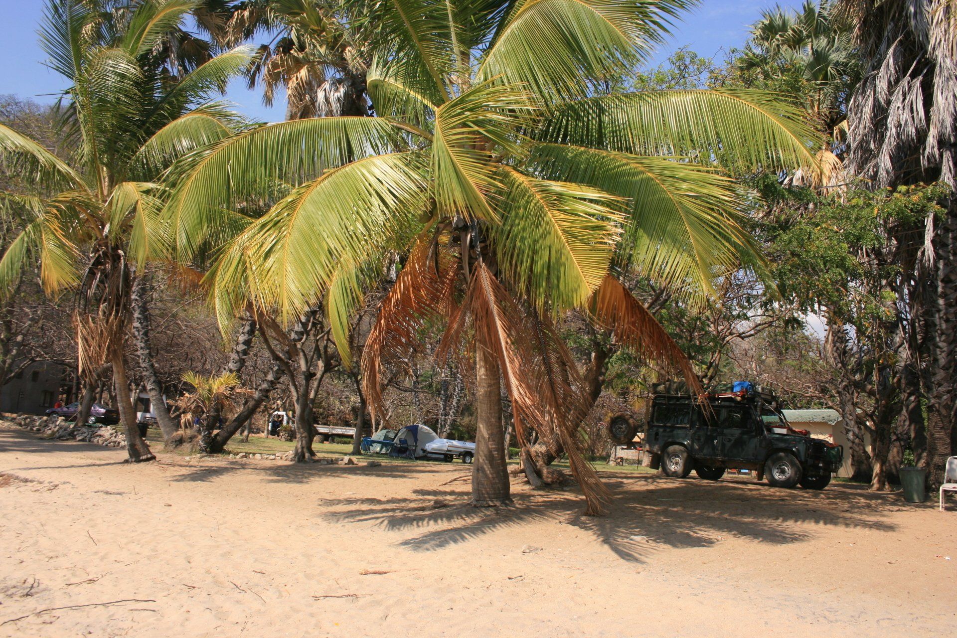
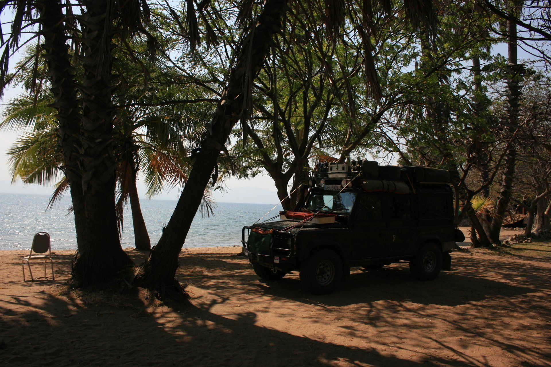
Camping – Golden Sands Camping, Lake Malawi National Park. Our pitch was on the beach alongside the lake. The place was run down. Ablutions left a lot to be desired; no water, save a bucket for the flush. No electricity.
Cost – US$1 per person per night. Paid in kwachas.
Coordinates - S14 02.331 E34 49.488
Altitude = 468 metres
Park fees – US$5 per person per day + US$1 per vehicle per day. Paid in kwachas.
Day 193 - Thursday 20th August 2009
Trip miles = 13912 miles (22259 kms) Daily miles = 0 miles (0 kms)
Daily Route – In Golden Sands Camp, Cape Maclear, Lake Malawi National Park.
Camping – as previous night.
Day 194 - Friday 21st August 2009
Trip miles = 13971 miles (22354 kms) Daily miles = 59 miles (94 kms)
Daily Route – Cape Maclear, Lake Malawi National Park down to Sunbird Hotel near Nkopola.
Camping – Sunbird Hotel near Nkopola on Lake Malawi. A reasonable site a little way down the beach from the main Sunbird Hotel. A large camping area without specific pitches alongside the lake; when we were there it was busy. Good but busy ablution block. No electricity lakeside but provided on specific pitches away from water.
Cost – MK740 per person per night.
Coordinates - S14 19.362 E35 08.848
Altitude = 475 metres
Day 195 - Saturday 22nd August 2009
Trip miles = 14057 miles (22491 kms) Daily miles = 86 miles (138 kms)
Daily Route – Sunbird Hotel near Nkopola down to Liwonde and into Liwonde National Park.
Camping – Chinguni Campsite, Liwonde National Park. A quiet site alongside the ‘Lodge’ and restaurant. Good ablution block in the Lodge. No electricity.
Cost – MK1050 per person per night.
Coordinates - S15 00.806 E35 15.721
Altitude = 498 metres
Park fees – US$5 per person per day + US$2 per vehicle per day. We paid in kwachas.
Day 196 - Sunday 23rd August 2009
Trip miles = 14117 miles (22587 kms) Daily miles = 60 miles (96 kms)
Daily Route – In and around Liwonde National Park.
Camping – Mvuu Campsite, Liwonde National Park. A small but popular site, particularly with backpackers and tourists ferried across the Shire River.Expensive. Nice Lodge and rooms and restaurant. Reasonable ablution block. No electricity.
Cost – US$15 per person per night.
Day 197 - Monday 24th August 2009
Trip miles = 14157 miles (22651 kms) Daily miles = 40 miles (64 kms)
Daily Route – In and around Liwonde National Park.
Camping – as Day 195
Day 198 - Tuesday 25th August 2009
Trip miles = 14220 miles (22725 kms) Daily miles = 63 miles (101 kms)
Daily Route – Liwonde National Park to Liwonde Town down to Zomba Town to Zomba Plateau.
Camping – Trout Farm Campsite, Zomba Plateau. A pleasant site in the middle of the woods on the Plateau. Reasonable ablution block with hot showers. Wood available. No electricity.
Cost – MK600 per person per day.
Coordinates - S15 21.174 E35 18.062
Altitude = 1510 metres
Park fees – None.
Day 199 - Wednesday 26th August 2009
Trip miles = 14220 miles (22725 kms) Daily miles = 0 miles (0 kms)
Daily Route – In and around Zomba Plateau.
Camping – as previous night.
Day 200 - Thursday 27th August 2009
Trip miles = 14307 miles (22891 kms) Daily miles = 87 miles (139 kms)
Daily Route – Zomba Plateau to Blantyre to Chikwawa.
Accommodation – Machenga Motel, Chikwawa. Adequate as an overnight room. There was a restaurant. Superior rooms had en suite facilities, albeit cold showers.
Cost – MK3000 for a double room and breakfast, for two.
Coordinates - S16 62.432 E34 47.720
Altitude = 142 metres.
Day 201 - Friday 28th August 2009
Trip miles = 14375 miles (23000 kms) Daily miles = 68 miles (109 kms)
Daily Route – Chikwawa to Lengwe National Park.
Camping – Lengwe National Park, Bush Camp No. 1. A typical bush camp in the middle of nowhere with no facilities whatsoever – brilliant.
Cost – US$5 per person per day.
Coordinates - S16 13.539 E34 47.52
Altitude = 133 metres.
Park fees – US$5 per person per day + US$5 per vehicle, one off payment.
Day 202 - Saturday 29th August 2009
Trip miles = 14452 miles (23123 kms) Daily miles = 77 miles (123 kms)
Daily Route – Lengwe National Park to Majete Wildlife Reserve.
Camping – Majete Wildlife Reserve Community Camp. A peaceful site near the Park entrance gate. Good ablution block. No electricity.
Tel 0999521741
Cost – MK700 per person per day.
Coordinates - S15 54.672 E34 44.505
Altitude = 127 metres.
Park fees – US$20 per person per day + US$4 per vehicle: this is according to the internet as we have no record or recollection of paying at the gate.
Day 203 - Sunday 30th August 2009
Trip miles = 14558 miles (23293 kms) Daily miles = 106 miles (170 kms)
Daily Route – Majete Wildlife Reserve to Blantyre and down to Mulanje Mountain Forest Reserve.
Camping – CCAP Likhubula Campsite, Mulanje Mountain Forest Reserve. A small campsite in what also doubled up as a ‘pubic’ car park for visitors to the river and falls
Reasonable ablution block with cold showers. No electricity.
Cost – MK360 per person per day.
Coordinates - S15 56.393 E35 30.153
Altitude = 812 metres.
Park fees – MK100 per person per day + MK200 per vehicle.
Day 204 - Monday 31st August 2009
Trip miles = 14632 miles (23411 kms) Daily miles = 74 miles (118 kms)
Daily Route – Likhubula Campsite to Phalombe, across to Nkhulambe and down to Muloza tracking the Ruo River for a while, the border between Malawi & Mozambique, before heading back around to Mulanje and the Likhubtulai Campsite again. Whilst there is a border crossing at Muloza the reported situation regarding visas was unclear and the crossing would take us too far north in Mozambique for our plans.
Camping – as previous night.
Day 205 - Tuesday 1st September 2009
Malawi to Mozambique
Trip miles to border = 14739 miles (23582 kms) Daily miles to border = 107 miles (171 kms)
Daily Route – Likhubula Campsite, Mulanje to Blantyre and Mwanza and into Mozambique.
